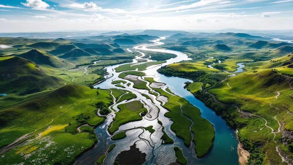
A drainage basin is a topographically delineated area where all precipitation converges to a single discharge point (pour point). You’ll find these natural hydrological units bounded by elevated ridges called drainage divides. Within basins, water flows via surface runoff (10-25% of precipitation) and groundwater percolation, creating dendritic network patterns. Basins function hierarchically with nodes (confluences) and links (channels), while their ecological integrity directly correlates with flood regulation capacity, reducing peak flows by 15-30% in vegetated watersheds.
Key Takeaways
- A drainage basin is an area where all surface water converges to a single discharge point called the pour point or outlet.
- Drainage basins are bounded by elevated ridges called drainage divides that separate adjacent watersheds.
- They form hierarchical networks with nodes (stream confluences) and links (channel segments) arranged in dendritic patterns.
- Drainage basins can be classified as exorheic (flowing to oceans), endorheic (flowing to internal lakes), or arheic (lacking defined drainage).
- They serve important ecological functions including water storage, flood regulation, nutrient cycling, and providing wildlife habitat.
Definition and Basic Components of Drainage Basins

A drainage basin constitutes a topographically delineated area where all surface water converges to a single discharge point, such as a river mouth, lake, or ocean.
You’ll find these units bounded by drainage divides—elevated ridges that separate adjacent watersheds.
The basin’s hierarchical structure comprises nodes (stream confluences), links (channel segments), and the pour point (outlet).
Drainage characteristics include network patterns resembling dendritic structures with main stems and tributaries.
Watershed importance lies in its function as a coherent hydrological unit, facilitating quantifiable water storage in surface bodies, soil moisture, and groundwater reserves.
Basins can be classified as open (exorheic) or closed (endorheic) systems. Additionally, effective stormwater management practices are essential in preventing flooding and erosion within these basins.
Types of Drainage Basins Around the World

Drainage basins around the world exhibit remarkable diversity in their hydrological characteristics, outflow destinations, and morphological patterns.
You’ll encounter exorheic basins discharging to oceans, endorheic basins terminating in internal lakes, arheic basins lacking defined drainage, cryptorheic basins flowing underground, and limnic basins collecting in freshwater bodies.
Dendritic, radial, trellis, rectangular, and parallel patterns emerge based on underlying geology and slopes.
From large continental-scale basins to microwatersheds, size considerably affects hydrosedimentary responses.
Climatic and topographic influences shape basin characteristics differently across arid versus humid regions.
Special types include glacial, coastal, urban, karst, and artificial basins with distinctive hydrological behaviors.
The Role of Drainage Divides in Watershed Formation
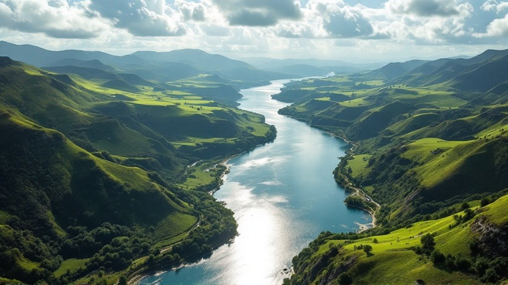
While water flows downward under gravitational forces, the topographic boundaries known as drainage divides dictate precisely which direction that flow takes. These watershed boundaries manifest as elevated terrains, typically ridgelines or mountain crests, that bifurcate precipitation runoff toward disparate drainage networks.
Continental divides separate oceanic destinations, while major and minor divides delineate hierarchical hydrological systems within regional geomorphology.
Water’s journey to the sea follows nature’s hierarchical blueprint, carved into the landscape by divides both grand and subtle.
- Drainage divides form triple points where three distinct watersheds intersect
- Topographical elevation differentials of divides correlate with basin discharge volume
- Valley floor divides often result from fluvial deposition or glacial modification
- Divide migration occurs through headward erosion at rates of 0.1-10mm annually
- Anthropogenic modifications to divides can redirect >50% of natural basin flow
How Water Flows Through Drainage Basin Systems
Water flows through drainage basin systems via two primary pathways: surface runoff, which transports 10-25% of precipitation across topographical gradients, and groundwater percolation, where infiltrated water migrates through aquifers at rates determined by hydraulic conductivity.
Surface runoff processes intensify when precipitation exceeds infiltration capacity, creating sheet flow that shifts to concentrated channelized flow.
Groundwater pathway dynamics operate on longer temporal scales, with throughflow moving laterally through soil horizons while deeper percolation contributes to baseflow that sustains channel discharge during dry periods.
Surface Runoff Processes
When precipitation contacts Earth’s surface, multiple hydrological pathways activate within drainage basin systems, constituting what we define as surface runoff processes.
You’ll observe that runoff measurement indicates flow velocity increases proportionally with slope gradient, while infiltration capacity determines the volume diverted to overland flow versus groundwater recharge.
- Overland flow initiates when precipitation rate exceeds soil infiltration threshold
- Interflow occurs laterally through soil horizons before reaching channel networks
- Basin morphometry directly correlates with hydrograph response times
- Channel roughness coefficient inversely affects discharge velocity
- Anthropogenic land-use modifications accelerate runoff coefficients by 30-75%
Groundwater Pathway Dynamics
Beneath the surface runoff processes previously examined, groundwater pathway dynamics constitute a complex subsystem within drainage basins that operates at multiple spatial and temporal scales. You’ll find that groundwater flow manifests through both local systems influenced by topography and regional systems controlled by geological structures like faults and fractures.
| Flow System | Primary Controls | Hydrologic Function |
|---|---|---|
| Local | Topography | Aquifer recharge |
| Regional | Fractures/Faults | Chemical transport |
| Intermediate | Heterogeneity | Baseflow maintenance |
Aquifer recharge occurs through infiltration and percolation processes, while discharge manifests via springs and seepage zones. These pathways create critical hydrological connectivity throughout the drainage basin, facilitating water and solute transport between terrestrial and aquatic ecosystems.
Ecological Significance of Healthy Watersheds
Drainage basins with ideal ecological functionality serve as critical components in maintaining terrestrial and aquatic ecosystem integrity.
These systems facilitate biodiversity enhancement through habitat provision and nutrient retention via complex biogeochemical processes. Your watershed’s ecological functionality directly correlates with ecosystem service delivery efficiency.
Healthy watersheds enhance biodiversity through intricate ecological mechanisms, delivering measurable benefits proportional to their functional integrity.
- Carbon sequestration rates increase 28-42% in intact riparian corridors
- Nutrient cycling efficiency improves water quality metrics by reducing eutrophication potential
- Wildlife corridors maintain genetic diversity coefficient >0.85 in connected populations
- Hydrological regulation reduces flood magnitude by 15-30% in vegetated watersheds
- Ecosystem resilience increases proportionally with biodiversity indices
Human Impact on Drainage Basin Dynamics
Urban expansion increases impervious surface cover by 25-75% in developed watersheds, resulting in 1.5-2x greater peak discharge rates and 30-40% reduced groundwater recharge compared to natural systems.
You’ll observe that agricultural modifications, including tile drainage and irrigation systems, greatly alter the water balance by extracting 70% of global freshwater usage and increasing sediment yield by 10-100x pre-agricultural levels.
These anthropogenic alterations to drainage basin hydrology quantifiably impact both the temporal distribution of streamflow and the basin’s sediment transport capacity, with urbanized basins exhibiting flashier hydrographs characterized by reduced lag times of 30-80%.
Urbanization Alters Water Flow
The transformation of natural surfaces into impervious cover represents one of the most significant hydrological alterations in drainage basin dynamics.
When you analyze urbanized catchments, you’ll observe accelerated urban runoff patterns characterized by decreased infiltration capacity and shortened residence times. Impervious surfaces fundamentally reconfigure the rainfall-runoff relationship, increasing flood risk by 37-48% in heavily developed watersheds.
- Increased runoff coefficient (0.70-0.95 vs. 0.10-0.30 in natural systems)
- Reduced groundwater recharge (up to 35% decrease)
- Heightened peak flow magnitudes (2-5x pre-development levels)
- Compressed lag time between precipitation and discharge
- Diminished water quality due to pollutant mobilization
Agricultural Watershed Modifications
While natural watersheds maintain equilibrium through balanced hydrological processes, agricultural modifications greatly disrupt drainage basin dynamics through multifaceted alterations to the water cycle.
Agricultural runoff increases sediment yield and reduces infiltration, accelerating hydrological flow rates by 30-40%. The “4R” nutrient management strategy mitigates nutrient loading, especially legacy phosphorus accumulation that continues to impact water quality.
Quantitative analysis reveals eutrophication from elevated nitrogen and phosphorus concentrations often requires 40% reduction targets in watersheds. Cover crops demonstrably decrease leaching while improving soil structure.
Implementation of riparian buffers strategically positioned between agricultural operations and water bodies considerably attenuates contaminant transport mechanisms.
Major Drainage Basins and Their Characteristics
Globally distributed across Earth’s landmasses, major drainage basins constitute the fundamental hydrological units that collect and transport precipitation through complex networks of streams and rivers.
You’ll find the Amazon Basin dominates at 7 million km², followed by the Congo (4 million km²), Nile (3.4 million km²), Mississippi (3.22 million km²), and Río de la Plata (3.17 million km²).
Each basin exhibits distinctive drainage density and peak discharge characteristics influenced by geomorphology and soil types.
- Amazon Basin’s extensive network facilitates maximum precipitation collection in the water cycle
- Drainage density varies inversely with infiltration rates
- Basin circularity correlates positively with peak discharge magnitude
- Soil composition determines infiltration-runoff ratios
- Endorheic basins terminate in inland water bodies rather than oceans
Sustainable Management Practices for Watershed Protection
Effective watershed protection requires implementation of scientifically-validated management frameworks that integrate hydrological modeling with ecosystem preservation strategies.
You’ll need to establish environmental thresholds for groundwater withdrawals based on quantifiable water budgets and high-integrity priority (HIP) stream classifications.
Implement contour trenches and soil bunding techniques to enhance infiltration rates by 15-30%.
Sustainable landuse practices must incorporate metered consumption systems and infrastructure upgrades to optimize water utilization efficiency.
Community engagement through targeted social marketing campaigns facilitates stakeholder participation in watershed governance, increasing compliance with best management practices by 40-60%.
These integrated approaches maintain hydrological parameters within established ecological limits.
